Geomap Online package at one glance
3,000 current maps at your fingertips
Access up to 3,000 base, structure, and executive reference maps instantly from your computer.
Easy-to-use interface
Find the information you need in seconds, using a search function, for example, to locate fields, wells, or Texas abstracts.
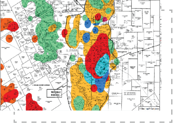
Create your own multilayered maps in minutes
Zoom in and out, switch layers on and off to display the structure and production horizon information simultaneously, and create your own multilayered maps with just a couple of clicks.
Save up to 17% on map access
Accessing maps via Geomap Online is about 17% less expensive than licensing them as .tiff files and about 30% less expensive than licensing them as .shape files.
You can get a free library membership by subscribing to Geomap Online.
Maps included in the Geomap Online package
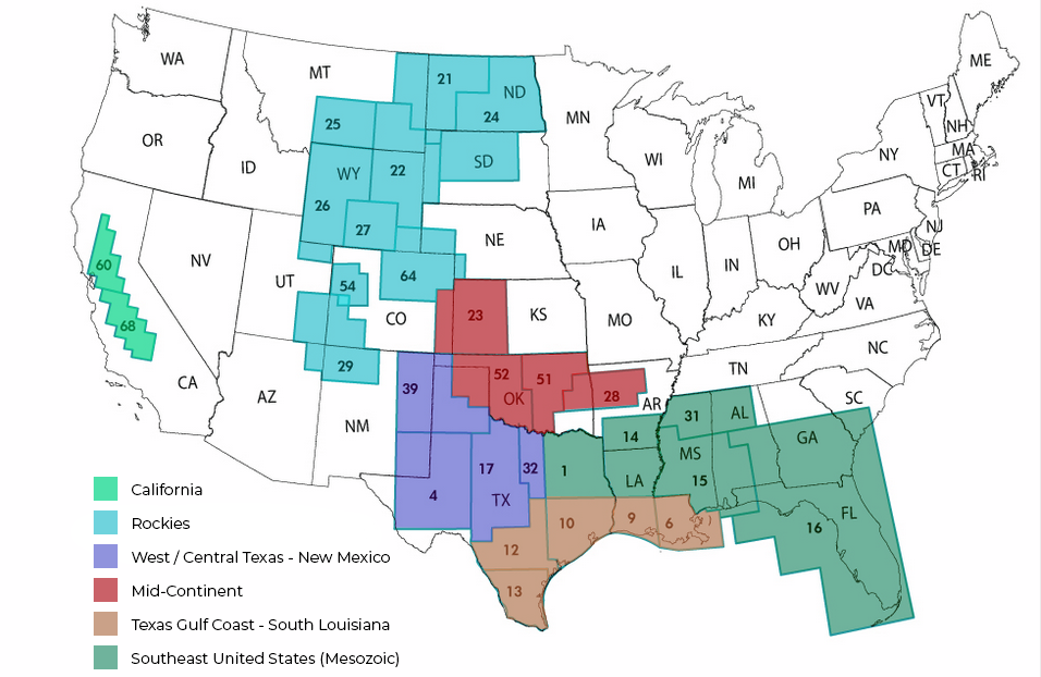
Get access to the base, structure, and production reference maps for the following areas.
How much does it cost?
The monthly subscription fee depends on the coverage area and ranges from $300 to $3,000 per month. The minimum subscription duration is three months.
Get access Geomap Online Please fill out the form below to request access to Geomap Online. Our sales team will reach out to you within 48 hours.
"*" indicates required fields
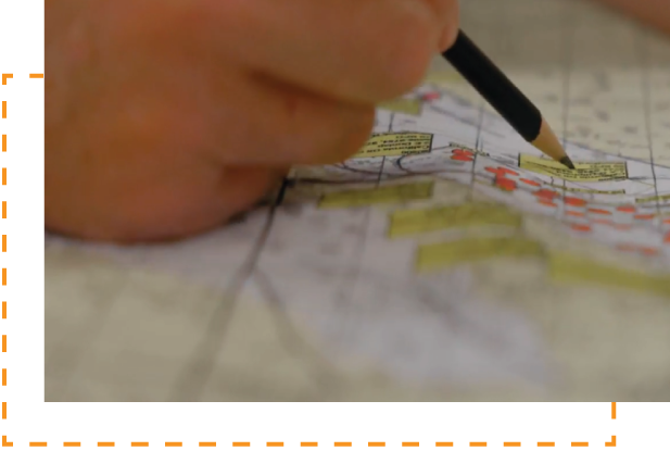
How Geomaps maps are created Hand-drawn by geologists with 30+ years of experience, updated quarterly
Creating a contour map is a highly interpretive process. And although a computer can create a map much faster, a map created by an experienced geologist is usually more accurate.
The reason for it is that a computer spreads contours while relying on a mathematical calculation and not a geological interpretation. But an interpreter who knows the geology of an area incorporates all the aspects of local geology into that contoured map.
For example, a computer might evenly space the contours between the two points with different elevations, where in reality a monocline may exist. An experienced geologist familiar with the area will include the axis of a monocline, which will result in a more accurate map.
Trusted by


3r

marathon

castex

Chesapeake
Chevron

Cresta Fund

DB-LOGO

Denbury

Devon

EOG

GCS

GeoSouthern

llog
petro hunt

ocelot

oxy

Pillar

Pioneer

Shell

SM

Steward

Stonetex

Talos

Tellurian

Texakoma

Wagner

WEYERHAEUSER
